The INLAND SLOPES - “Box-Ironbark Country”
This region, on the inland slopes of the Great Dividing Range, is bounded to the north by the flat alluvial plains of the Riverina. From Stawell in the west to Wodonga in the east, the varying soil types and rainfall levels create a mosaic of woodlands, shrublands, scrubs and forests. The area has historically been heavily impacted by grazing, logging and gold mining, but in recent decades more areas have received higher protection for conservation of the many threatened species clinging on in the landscape. Geology:

This region is characterized by scattered hilly ranges surrounded by broad plains and undulating country. The most widespread bedrock in Victoria is of Ordovician origin (440 to 500 million years old), and the extensive “goldfields” region of central Victoria (Bendigo and Ballarat) is the best known outcrop of these ancient formations. These typically hard and poor soils are made up of quartz sandstone, siltstone and black shale. Large quantities of gold were mined from the region and there are still active gold mines operating today. Some of the largest nuggets ever found in the world came from the Victorian goldfields, including the “Welcome Stranger” weighing in at around 80 kgs found near Moliagul (was melted down), and the “Hand of Faith” which now sits on display in a Las Vegas casino. North of Bendigo low sedimentary ironstone ridges occur. East of Bendigo the north south running “Heathcote Greenstone Belt” is an example of Cambrian era rock formations which are even older at 500 + million yrs, a time before there were even any land plants. This rock was quarried by Aboriginal peoples for tools and weapons.
Other rocky hills are formed from granite, hornfels, and dacites, all extremely resistant, which have become exposed as surrounding lands eroded away over millions of years. Surrounding granitic outcrops the feldspar, mica and quartz weather to provide sandy environments fanning out. Some of these are outliers in the riverina district such as Terrick Terrick and the Warby Ranges.
Climate:
With south-westerly prevailing winds, precipitation occurs across the higher hills to the south, with the slopes and plains to the north receiving lower average rainfall totals ranging from 400 to 600 mms annually. Summers are warm and dry, with winters cool to cold and wetter. Frosts are common in winter as well as mist and fog which occasionally can last through to the middle of the day in the right conditions. Rainfall is quite variable across the years with droughts and flooding rains.
Vegetation Types :
The dominant tree species (mostly Eucalyptus) are largely determined by where on the slopes you sit. Along the water courses River Red Gums (E. Camaldulensis) grow where flooding occurs regularly (note they also grow on some granite hills). The surrounding fertile low lying plains and slopes were largely grassy woodlands of Yellow Box (E. Melliodora) and with some Grey Box (E.Microcarpa) and Buloke (Allocasuarina luehmannii). Being out of the flood zone and very fertile these woodlands have been extensively cleared for agriculture, with small remnants and roadsides all that remain in many areas.
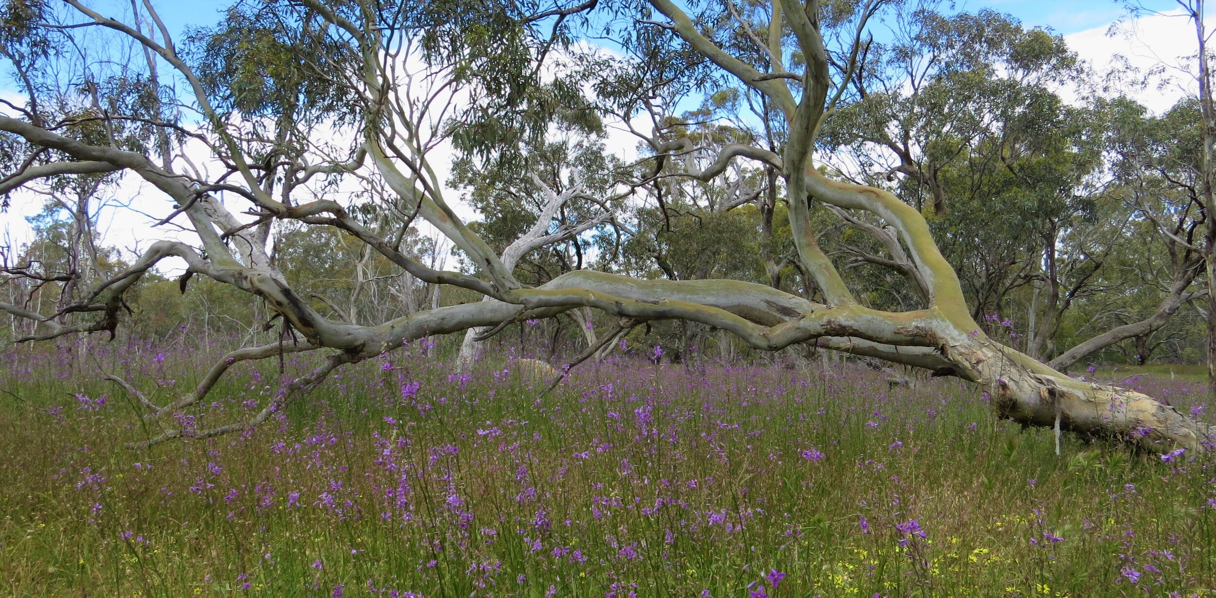
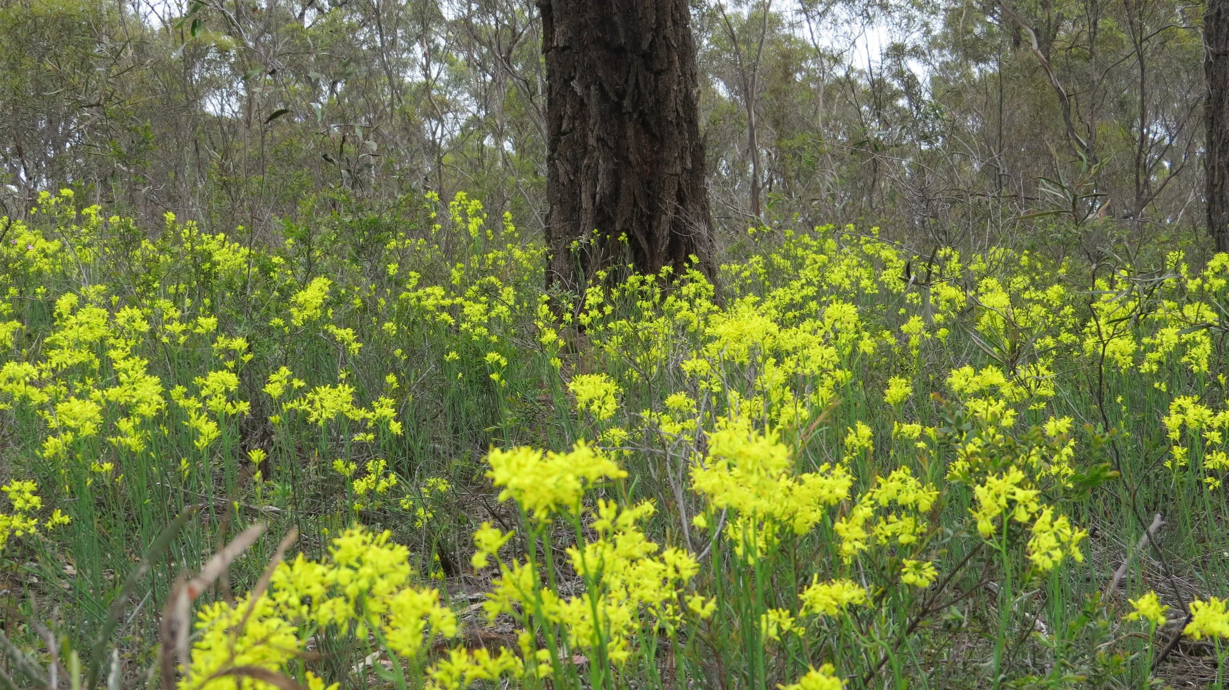
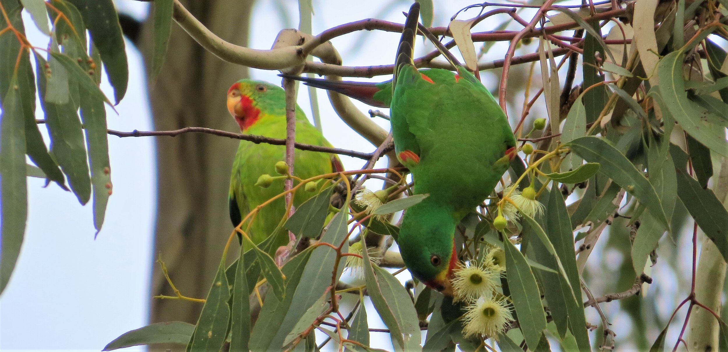
On the extensive undulating slopes of the region the commonest trees are Grey Box, Yellow Gum (E.Leucoxylon), White Box (E.Albens) and Red Ironbark (E. sideroxylon). Mixed forests of these species are commonly found and with the differing flowering times for each tree type nectivorous birds have a feast throughout the year. Ground cover varies with grasses dominating more fertile areas. Poorer soils can support a rich diversity of flowering shrubs and both annual and perrenial wildflowers including terrestrial orchids
Some other trees forming usually mixed woodlands on the slopes include Long-leaved Box (E.Goniocalyx), Red Box (E. Polyanthemos), Red Stringybark (E. Macrorhyncha) and Blakely’s Red Gum (E. Blakelyi)
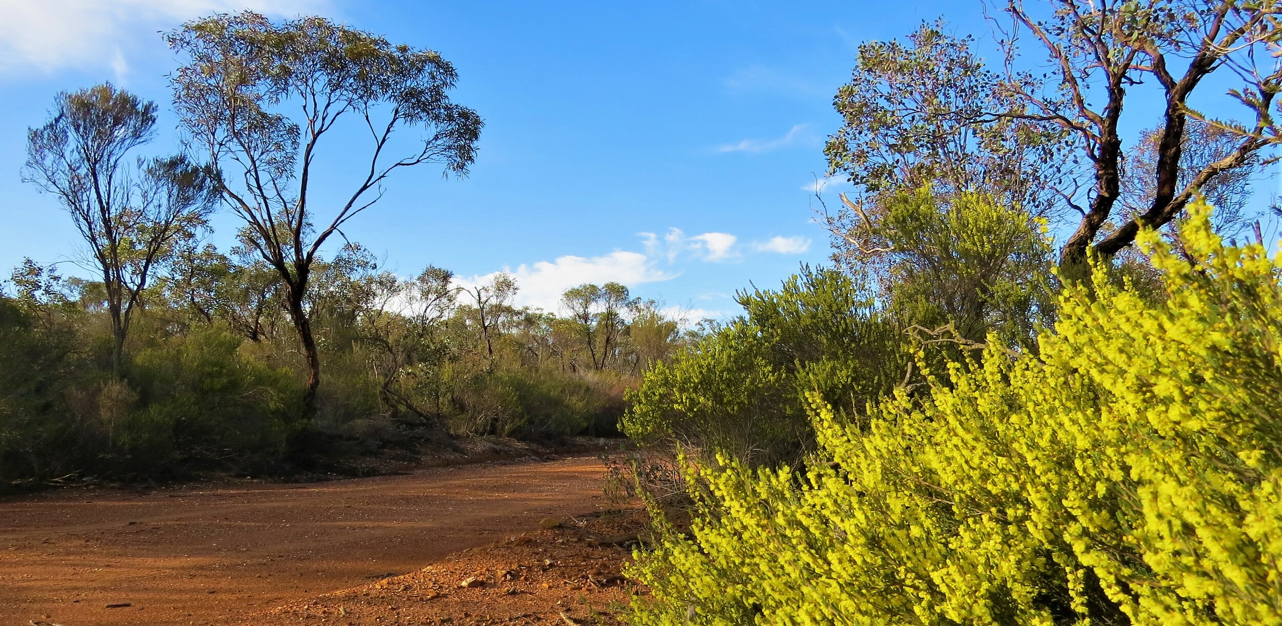
North and north-west of Bendigo the least fertile soils on the low ridges support mallee scrubs, whilst some granite outcrops in the drier areas are dominated by Acacia shrublands
Site Descriptions:
Wychitella Flora and Fauna Reserve
Situated between Boort and Wedderburn in north-central Victoria, the low hills of Wychitella are the last remnants of the ranges as you travel north before reaching the flat plains of the riverine country. These dry woodlands are a mix of Box-Ironbark forests, granite outcrops and mallee woodlands and a visit is sure to offer peace, tranquility and birds. The reserve is in several discrete blocks, with cleared land in between, however in recent years several properties have been returned to conservation and are regenerating. This is one of only a few mallee areas in central Victoria, where birds such as Shy Heathwren, Purple-backed Fairy-wren, Inland Thornbill and Southern Scrub-robin may be found without having to drive further out to north-west Victoria.
Getting there
The Calder highway runs through Wedderburn which lies just to the south of the best areas. Then either take the Wedderburn Boort road to access the Korong Vale block, the Old Boort road to access the Granites, or take the Wedderburn Wychitella road for access to the Wychitella block. The Skinners Flat block is accessed off the Calder highway north-west of Wedderburn on the Skinners Flat/Mt Kerang road
Key sites
The Skinners Flat block preserves box-ironbark forest in the south and mallee in the north, with the Mt Kerang road providing access. To the north-west of this block is Mt Kerang and the Nardoo Hills reserve, now owned by private conservation organisations, thus extending the area.
The northern Wychitella block is mostly mallee as well, with Wattle track providing some access to some nice mallee heath.
The Korong Vale block is accessed from near Korong Vale along Eucy road and then left into Fahey road which takes you to the old reservoir. The birding around the reservoir is excellent and from there tracks lead to mallee woodlands and heathlands.

The Granites (Mt Egbert)is accessed off the Old Boort road and comprises of hills with granite boulders and acacia shrublands, very similar to the nearby and impressive Mt Korong to the south.
Key Species
Malleefowl (rare and hard to find), Brush Bronzewing, Black-eared Cuckoo (spring), Purple-backed Fairy-wren, Tawny-crowned Honeyeater, White-fronted Honeyeater, Purple-gaped Honeyeater (rare) Black-chinned Honeyeater, Painted Honeyeater (Mt Korong and The Granites), Shy Heathwren, Inland Thornbill, Red-capped Robin, Hooded Robin, Gilbert’s Whistler, Southern Scrub-Robin, Diamond Firetail
Kooyoora State Park
A little further south and receiving a little more rain than Wychitella, Kooyoora state park does have some mallee areas, but mostly consists of Box-Ironbark forests, and granite outcrops with Blakeleys Red Gum. This is an area where some dry country birds overlap with species from further south, and is a regular wintering area for Swift Parrots
Getting there
From Melbourne take the Calder towards Bendigo, turning off to bypass the city and reach Marong. From near Marong take the St Arnaud road (Wimmera highway) through Tarnagulla and Moliagul (good forests through here too) and then up to Rheola and Kooyoora
Key sites
The main block north-west of Kingower includes the Melvilles caves area and Mt Kooyoora itself. This is mostly Blakeleys red gum woodland with a wattle understory on granite hills. Lower down the slopes Grey Box and Yellow Gum forests dominate. The granite areas are great for smaller bush birds such as Thornbills and Robins. Both Gilberts Whistler and Speckled Warbler are a good chance here.
The Wehla block further west is an extensive area of Box ironbark forest, particularly lively in winter and spring when there is more flowering and nectar. Swift Parrots use the area most winters along with many other lorikeets and honeyeaters. Grassy Flat track, White Box track the Bealiba-Wehla road and the Burkes Flat- Wehla road are all good places to try.
The Glenalbyn block and Sunday Morning Hills block include a range of habitats. The mallee areas along the Sunday Morning Hills road are harvested for Eucalyptus oil and can be good for Tawny-crowned Honeyeater.
Kingower State forest just south of Kingower is another Swift Parrot wintering area, with Gap road and the southern parts of the forest along Pigeon road being the most productive
Key Species
Swift Parrot, Little Lorikeet, Purple-crowned Lorikeet, Gilberts Whistler, Speckled Warbler, Scarlet Robin, Black-chinned Honeyeater, Tawny-crowned Honeyeater
Greater Bendigo National Park and Bendigo Regional Park
The recently declared National Park, and the Bendigo Regional Park includes hilly country right around the city of Bendigo, north, south, east and west. Much of these parks consists of regrowth forest, with the country not being permanently cleared for agriculture due to the 1850’s gold rush around the Bendigo region and the need for timber. Current threats include regular controlled burns and grazing pressure from Kangaroos damaging the understory, however there are many pockets of excellent habitat remaining.
Getting there:
Bendigo is only 150 kms north of Melbourne via the Calder Freeway. Some good forest areas reach close in to the city whilst other parts of the park extend some 25 kms or more from Bendigo’s CBD.
Key sites:
There are many tracks to explore in this park, and due to the hard stony ground many are fine to drive in all weather.
To the south in the One Tree Hill, Sedgewick and Mandurang areas are forests of Grey, Yellow and Long-leaved Box, Red Stringybark and Yellow Gum with a mostly intact ground cover of native shrubs and forbs. As is typical in these drier woodlands, honeyeater species tend to dominate in areas of taller older trees in the gullies where nectar is more abundant. Smaller less aggressive bush birds such as thornbills, fantails and robins are found in the tougher conditions on the ridges and where the soils are poorer and the trees more stunted. The Chestnut-rumped Heathwren is to be found here especially where there is a good layer of low heathy shrubs. A wide range of other woodland species are present. Swift Parrots often visit especially in autumn, Painted Button-quail favour the drier ridges, and Scarlet Robins are relatively common. Crusoe Reservoir No.7 park is part of Bendigo State forests, and easily accessed off the Calder highway just south west of Bendigo near Kangaroo flat. Some nice woodland combined with the reservoirs can add up to a healthy bird list in a relatively short time.
To the north of Bendigo in the “Whipstick” forest Grey Box and Yellow Gum trees dominate, but after a few kms this gives way to mostly Red Ironbark and the lower growing mallee vegetation where the soils are their poorest. The birding is worthwhile throughout, with the mallee areas of the northern Whipstick forest and the Kamarooka section holding some of the scarcer sought after specialities such as Shy Heathwren, Purple-gaped Honeyeater and Tawny-crowned Honeyeater. Areas of particular note include around Skylark road, Blandfords road, Mellotes road, Burnside Road and Campbells road. A few hundred metres west along Campbells road is an old distillery dam which is used by many birds in hot weather.
In the very northern parts of the Kamarooka section of the park such as along Camp road, the land gradually descends back down onto the plains, and as the soils improve , Grey Box and Yellow Gum forests return. These can be good for Honeyeaters and Lorikeets when in flower.
Key Species:
Chestnut-rumped Heathwren, Shy Heathwren, Purple-gaped Honeyeater, Tawny-crowned Honeyeater, Gilberts Whistler, Crested Bellbird
Heathcote-Graytown National Park and Rushworth State Forest
From Heathcote to Rushworth, Nagambie and Puckapunyal lies a region with extensive box-ironbark forest much of it now protected. Unlike the Bendigo region, there are no extensive mallee woodlands here, but the slightly higher rainfall, variety of vegetation and interconnectedness of this large area make it an important refuge for a wide range of threatened box-ironbark species
Getting there
Heathcote is around 100kms north of Melbourne. Take the Hume freeway to Wallan and then the Northern highway through Kilmore and on to Heathcote
Key sites:
Mt Ida is accessed from the Northern highway just north of Heathcote. Around its base larger trees are a good habitat for nectivorous birds. Once driving up the fairly steep slopes the vegetation becomes more stunted, with a heathy understory. A good site for Speckled Warbler and Scarlet Robin
Forest Drive, accessed a few hundred metres along the Nagambie road, follows a creek along the base of the McIvor range and has a wide range of species including Painted Button-quail, Black-eared Cuckoo (spring), Yellow-tufted, Black-chinned and Fuscous Honeyeaters, and Speckled Warbler.
Graytown, Mt Black and Spring Creek are accessed further along the Nagambie road. Ironbark, Box and Stringybark trees grow on the ridges, Yellow Box and River Red Gum grow along the drainage lines, and Grey Box and Yellow Gum is to be found on the flats and slopes. The diversity of trees supports a good diversity of nectivorous species with Swift Parrots present each winter and Barking Owl resident in the district.
Baillieston just east of the National Park has quality roadside vegetation, uncleared private lands and sections preserved in historic reserves and is a superb area for birding. The Rushworth Nagambie road runs through the area providing access to the Historic reserves where Gilberts Whistler and Crested Bellbird may be seen. Swift Parrots may be found in winter, and Painted Honeyeaters in spring. Pontings lane is one site to try for this localised bird. Spotted Quail-thrush are occasionally encountered also. A feature of this area are the stands of Grass-trees.
Rushworth State Forest just to the north contains large areas of Red Ironbark, which flower less frequently than some eucalypts, but when they do are magnets for nectar feeders. There are also some small mallee areas here which were used for oil production but too small and isolated to regularly support any specialities
Key Species:
Painted Button-quail, Swift Parrot, Little Lorikeet, Black-eared Cuckoo, White-bellied Cuckoo-shrike, Crested Bellbird, Gilberts Whistler, Black-chinned Honeyeater, Painted Honeyeater(rare), Speckled Warbler, Chestnut-rumped Heathwren, Diamond Firetail
Warby-Ovens National Park

This park in north-east Victoria preserves three distinct areas. The granitic hills of the Warby Ranges, the Ironbark forests of Killawarra, and the River Red Gum forests and wetlands of the Ovens river, one of very few unregulated rivers in Victoria.
Getting there:
The Warby‐Ovens National Park is 240km north east of Melbourne and 10km west of Wangaratta. The Warby Range road runs along the eastern side of the hills with various access points. Wangandary road cuts across the middle of the ranges and Boweya road provides access to the Killawarra forest to the north. The Wangaratta Yarrawonga road follows the lower Ovens floodplain up to Yarrawonga
Key sites:
In the southern section of the Warby ranges Taafe road, Taminick Gap road, Delloro road and Shanley st all provide access to tracks into the park. Turquoise Parrots may be seen especially around the edges of the park.
Wangandary road which becomes the Thoona road cuts through the middle of the ranges giving access to Ryans lookout and the Pine Gully nature walk. Waterholes along Adams road to the south and Jones Road attract birds to drink. Driving Adams road north which leads onto Tower road takes you through a range of forest types until you come out at the northern end on the Boweya road. Grey Box track follows the edge of the park on the western side and is also a good site for Turquoise Parrot.
The Killawarra forest is largely Red ironbark and is heavily infested with mistletoe. When flowering this forest attracts good numbers of nectivores including Swift Parrots. The mistletoe also attracts Painted Honeyeaters every spring/summer to breed. The camp site in the centre of the forest is quite reliable for this species.
Ovens river: There are many access points along the river, most of which are inaccessible when it floods, which it does with some regularity! It is one of the most natural riverine forests in Victoria with healthy Red Gum forests and associated bird species.
Key Species:
Warby Ranges: Turquoise Parrot, Western Gerygone, Scarlet Robin, Red-capped Robin, Speckled Warbler, Gang Gang Cockatoo (autumn/winter)
Killawarra forest: Swift Parrot, Painted Honeyeater, Speckled Warbler
Ovens River: Little and Noisy Friarbird, Scared and Azure Kingfisher, White-bellied Sea-Eagle, Brown Quail, Dollarbird and Barking Owl
Chiltern Mt Pilot National Park
This area is probably Victoria’s best known box-ironbark birding site, largely due to the fact that it supports the last population of Regent Honeyeater left in the state. It is also home to many of the other rare and threatened birds found in this habitat type, with specials such as Turquoise Parrot and Painted Honeyeater regularly seen.
A full annotated bird list is available at the Friends of Chiltern website http://friendsofchiltern.org.au/index.php/biodiversity/birdlist-chiltern-mt-pilot-np
And a useful guide for birdwatchers can be found here http://www.tourisminternet.com.au/chbird.htm
Getting there
Around 270 kms north-east of Melbourne via the Hume freeway. Chiltern township is just off the freeway and a good place to start. The Chiltern forest lies north and south of the freeway, the Mt Pilot section is further south again
Key sites
North of Chiltern: The site of recent release of captive bred Regent Honeyeaters, the forests to the north of town are amongst the most visited. 3kms from Chiltern on the Howlong road is Bartleys block, a cleared area on the west side of the road. Many of Chilterns species are regularly reported here including Turquoise Parrot and Painted Honeyeater and occasionally Regent Honeyeater. Better sites for Regents include Green Hill dam on Green Hill road and Klotz track, however this species is notoriously nomadic and generally only present from April to October. All the other tracks are worth exploring with perhaps Donchi Hill track and Ryans track, Frogs Hollow being of particular interest.
Just outside the park Grey-crowned Babblers may be seen along Fishers road.
South of Chiltern: Drive under the freeway and turn immediately left on to Lancashire Gap road. The Honeyeater picnic ground and Cyanide dam is another potential Regent Honeyeater site, and both Swift (winter only) and Turquoise Parrots are often about. Birds will come to drink here in hot weather. The White Box walking track starts here, a regular place for Painted Button-quail. Skeleton Hill track rises over a dry ridge where smaller bush birds may be seen such as Scarlet Robin and Buff-rumped Thornbill. Chestnut-rumped Heathwren has been seen here but is not easy.
Chiltern Valley Dams (Nos. 1 and 2): West of town along the Chiltern Valley road are a number of wetlands well worth visiting. There are also wetlands on private land, such as the one adjacent to No 1 dam which can also be good, plus the roadside trees are pretty lively.
Mt Pilot: The granitic ranges of the Mt Pilot section of the park are much more extensive, but less visited then the Chiltern section, but well worth the trouble if time allows. Barking Owl, Square-tailed Kite and Spotted Quail-thrush are three good reasons to explore the area, which has slightly higher rainfall. The Old Coach road is a good place to start, with the to the summit of Mt Pilot worth the views.
Key Species:
Square-tailed Kite, Painted Button-quail, Gang Gang Cockatoo, Swift Parrot (winter) Turquoise Parrot, Barking Owl, Regent Honeyeater, Painted Honeyeater