REGION 4. North-West Victoria - the Mallee Country
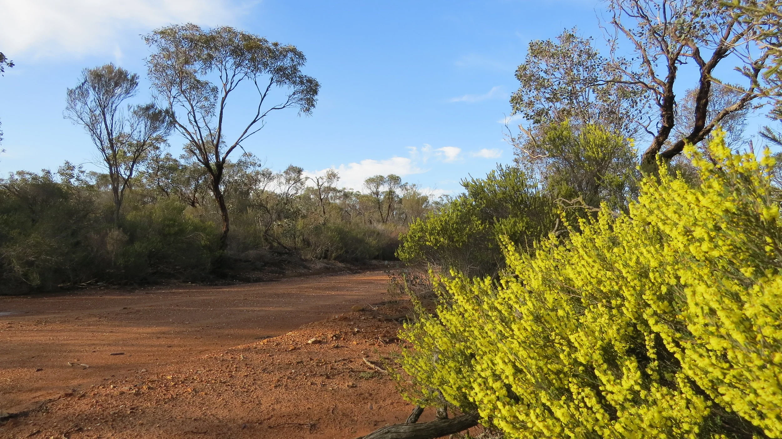
The “mallee” country of Victoria, some 400+ kms from Melbourne, is bounded by the South Australian border to the west, the Murray river to the north and stretches south and east to Swan hill, Wycheproof, Dimboola and the Little Desert. It is a region where agriculture is at its limits of viability with large tracts of land remaining uncleared and pristine making it one of the state’s birding highlights.
Some planning is required when visiting the mallee region. Heatwaves in summer (mid Dec to mid March) may mean birding is only possible in the mornings The remoteness, lack of phone service and the bush tracks where it is easy to become bogged in deep sand can be an issue and when walking in typical mallee country it is extremely easy to become disorientated especially on a cloudy day. It is strongly recommended that you either stay to formed tracks, or if you do wander into the scrub take a GPS or mark your way.
This is a truly unique ecosystem. At any time of the year a visit will be productive for birds. A number of stunningly beautiful species occur here.
A shifting dune with Cypress Pines in Wyperfeld NP
Geology : Being mostly below 200 metres altitude this region has been formed through the rising and falling of the oceans, especially during the Tertiary period tens of millions of years ago when the inland sea reached as far as Balranald in NSW. In the last few million years both water laid and wind blown sediments have overlain those of earlier times. The “Murray Mallee” consists of red-brown calcareous clay sands, forming east west running dunes which have apparently been stable for the last few thousand years. In contrast much of the more western section of Victoria’s mallee country (called the Lowan Mallee and including the Sunset country, and the Big and Little Deserts) have large areas of loose siliceous pale yellow and whitish sands which appear as wind-blown ‘tongues” stretching from South Australia and have formed irregularly jumbled dunes up to 10 metres high or more. The retreating seas also left salt in the environment which can collect at the lowest points in the landscape and has become more concentrated due to higher water tables following land clearance. Adjacent to the major watercourses of the Murray river and the Wimmera river, alluvial flats occur with heavier clay soils.
Climate : This region has the state's lowest rainfall and highest average daytime temperatures. Annual rainfall varies from 220 mms in the far NW to nearly 500 mms in the Little Desert region. Daytime temperatures average higher here than elsewhere in the state throughout the year however nights are often cold and frosts are common in winter. Average summer daytime temperatures are in the 30’s with days of 40 plus degrees every year, and sometimes lasting for a few days in a row. In the winter daytime temps average 13 to 16 degrees celcius. Rainfall variability from year to year is high, so droughts can be severe, whilst other years can be a boom time with rainfall totals doubling.
A summer sunrise in the mallee
Vegetation Types :
Large areas of the region are dominated by the “mallee” eucalypts, a group of mostly low growing multi-stemmed trees with underground lignotubers from which they can quickly recover after fire or drought. Common Eucalypts include Yellow Mallee (Costata), Dumosa Mallee (Dumosa), Yorrell or White Mallee (Gracilis), Slender-leaved Mallee (Leptophylla), Oil Mallee (Oleosa) and Red Mallee (Socialis). These open mallee scrubs have an understorey of various shrubs such as varieties of Acacia, Callitris, Dodonaea, Melaleuca, Olearia, Phebalium and Senna to mention a few. In the drier and poorer soils the ground cover tends to be dominated by Triodia (Porcupine grass) which is a prickly home to many reptiles and birds. In more fertile mallee communities more grasses and herbs may occur. Swales between the dunes often support a range of chenopod species, such as bluebush and saltbush which provide fruit throughout the year supporting many birds, insects and reptiles. Complex mosaics of the various vegetation communities often occur.
A misty winter’s day
The Lowan mallee with its less fertile sands supports a more stunted “mallee heath”, with a very diverse range of small shrubs such as varieties of Acaci, Allocasuarina (dwarf She-oaks), Callitris (scrub-pine), Melaleucas (such as Broombush and Honey-Myrtle), Leptospermum (tea-trees), Baeckeas, Calytrix, Comesperma, Cryptandra, Grevillea, Hibbertia, Leucopogan, Micromyrtus, Banksia, Xanthorrhoea (Grass Trees) and many more !
Eucalypts , typically the Yellow Mallee (Eucalyptus costata) and Slender-leaved Mallee (Eucalyptus leptophylla), may become more scattered or even absent in areas of deep loose sand dunes ( heathland). Again complex mosaics of Mallee, Mallee Heath and Heath can occur.
Deeper red-brown sands and lunettes associated with lake beds and creek systems support Casuarina (Buloke and Belah) and Callitris (Murray Cypress Pine) woodlands. Much of this habitat has been disturbed by grazing and logging with the best remaining areas in Wyperfeld, at Timberoo and Yarrara.
All these vegetation types are affected by wildfire, with the frequency and time since the last burn determining the structure of the habitat. Long unburnt areas allow the plants to mature and open out. Even scrub pine may develop into a 4-5 metre woodland without fire.
Along the rivers and floodplains with heavier clay soils River Red Gum (Eucalyptus camaldulensis) and Black Box (Eucalyptus largiflorens) trees grow large and spreading, providing nest hollows favoured by many birds and animals.
Site Descriptions :
Wyperfeld National Park
Cypress Pine and Casuarina woodland in Wyperfeld NP
Getting there: There are two main access points. Via Hopetoun and Yaapeet in the south, or via Patchewollock in the north. Both are well signposted.
Key sites: On entering the southern part of the park, the main entrance road follows the nearly always dry Outlet creek, through Black Box woodland and surrounding dunes with Cypress pine. Many Kangaroos and a range of dry country woodland birds may be seen including Regent Parrots.
The Discovery walk starts at the Wonga campground and travels over high dunes covered in tea-tree heathland with scattered mallee trees. Good for Shy Heathwren, Inland Thornbill, Splendid Fairy-wren, Gilberts Whistler and Southern Scrub-robin and with luck Redthroat, but avoid the heat of the day in summer. Recent sightings of Mallee Emu-wren have been made here also.
Eastern Lookout drive takes you to typical mallee eucalypt woodland, home to Chestnut Quail-thrush and Malleefowl. Try walking along Lowan track or Dattuck track which are both 4wd only.
Desert Walk is also dune heathland with similar species to the Discovery walk
In the north the open country with woodlands of Cypress Pine and Casuarina is great for Emu, Western Grey and Red Kangaroos, and Major Mitchells Cockatoo. Try Mt Jenkins track, Outlet Creek track, Gunners track or Snowdrift Picnic area.
Meridian track heading south travels through an open shrubby Cypress pine and Casuarina woodland with Gilberts Whistler, Splendid Fairy-wren, White-browed Treecreeper, Striped Honeyeater and Mulga Parrot. Moonah track (4wd) takes you to a mallee ridge with Shy Heathwren, Southern Scrub-Robin and Malleefowl.
Key Species: Emu, Regent Parrot, Mulga Parrot, Major Mitchells Cockatoo, Malleefowl, Chestnut Quail-thrush, Striped Honeyeater, Shy Heathwren, Southern Scrub-robin, White-browed Treecreeper, Gilberts Whistler, Black-eared Cuckoo, Redthroat.
Murray-Sunset National Park
Pheenys track
Getting there: From Ouyen either drive west on the Mallee Hwy towards Adelaide for access to the southern sections of the park, or continue north on the Calder Hwy for access to eastern and then northern sections. This is big country and quite remote, so be well prepared. It is always advisable to let the ranger know of your visit.
Key sites: The whole of the park is worth exploring, but distances and road conditions are the limiting factor.
The Wymlet tank area can be accessed by driving north on Meridian road from Walpeup. Close to Walpeup roadsides can be very birdy with pine, mallee and emubush habitat. The road becomes a bit sandy on the rises but can be used by 2wd with care. Once you reach the park you arrive in mallee vegetation. Turning right takes you down to the site of Wymlet Tank, a permanent water source, where birds come to drink in the heat of summer. The mallee woodland here is good for Emu, Australian Owlet-Nightjar, Mulga Parrot and Australian Ringneck, Crested Bellbird and Red-capped Robin plus many other woodland species. Turning left at the end of Meridian road takes you onto Honeymoon Hut track which eventually ends up close to Pink Lakes. This is a 4wd only track. This long track can produce many of the mallee specialities including the rare Red-lored Whistler.
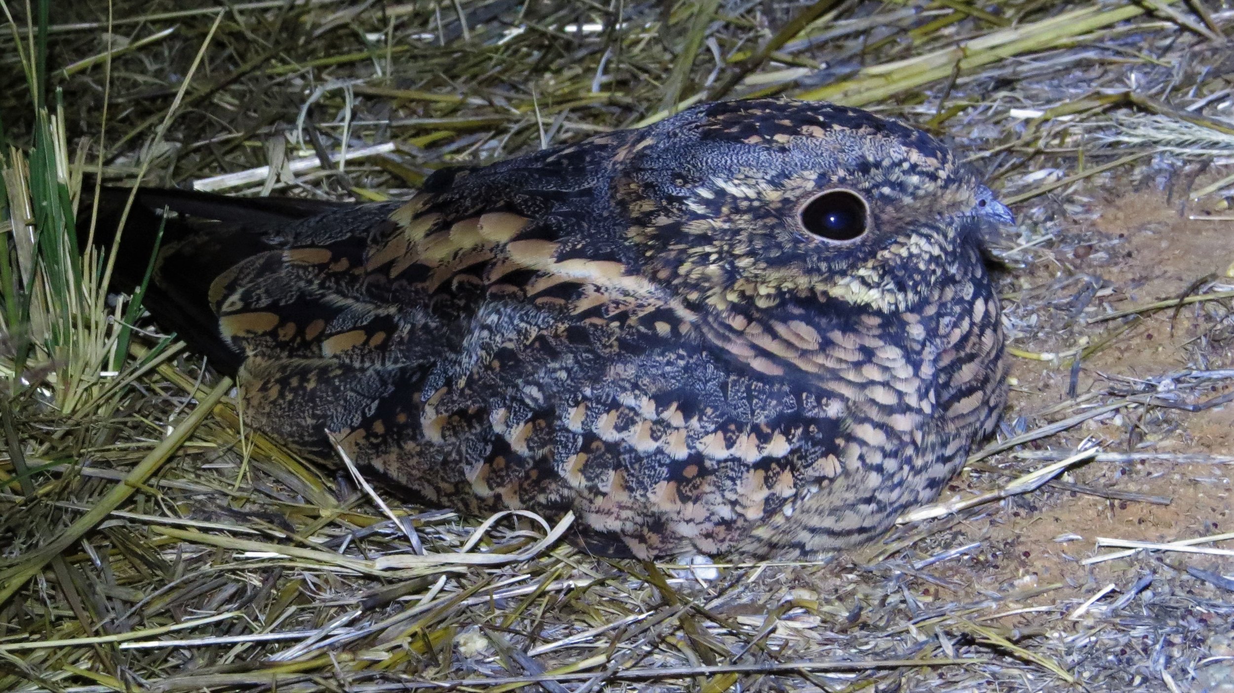
Along the way look for Mulga Parrot, Striped Honeyeater, Crested Bellbird, Masked Woodswallow and Chestnut Quail-thrush. Malleefowl may be spotted on the track early morning, and the denser spots have Shy Heathwren and Southern Scrub-robin. Both Spotted Nightjar and Australian Owlet-Nightjar are present through the area.
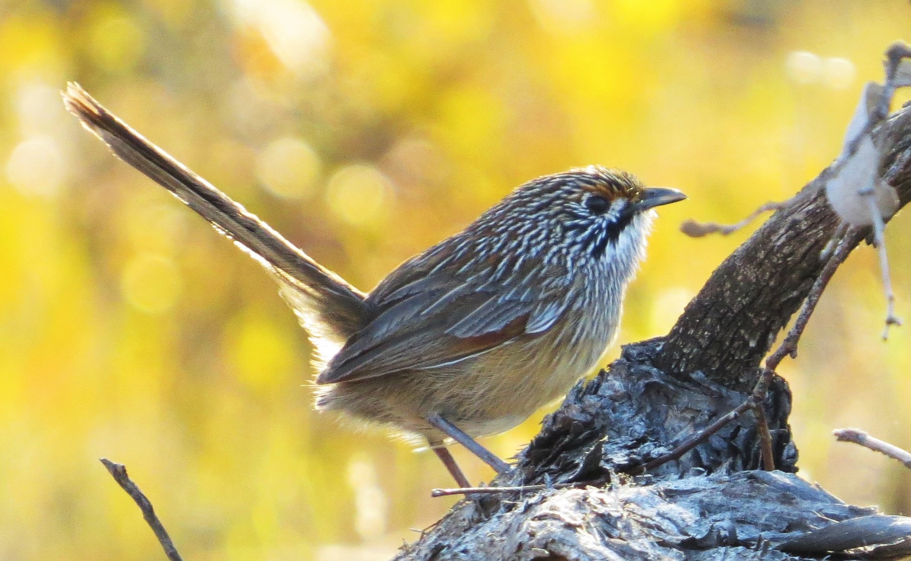
Quicker access to Pink Lakes is via a drive north from Linga just west of Underbool. The well maintained tracks here take you through open country around the salt lakes where Black-faced Woodswallow, Major Mitchell Cockatoo, Blue Bonnet etc may be sighted. The more open mallee woodlands have Crested Bellbird, Mulga Parrot, Southern Whiteface , and the denser mallee spinifex woodlands along Pioneer drive hold populations of Striated Grasswren, Mallee Emu-wren, Striped Honeyeater and Mulga Parrot. The 4WD Salt Bush Flat track runs off Pioneer Drive and takes you through some quality mallee woodland where Malleefowl and Chestnut Quail-thrush are scarce residents. A peaceful and safely accessed area well worth a couple of days.
Lake Kenyon in the Pink Lakes area of Murray-Sunset NP
The Raak plain is an area between the Calder highway and the National Park, and can be accessed by driving west from Hattah along Last Hope track. This drive takes you through a range of habitats including gypseous flats ( look out for Blue Bonnet and White-backed Swallow), mallee spinifex woodland ( possible Mallee Emu-wren) and open grassy plains ( a chance for Major Mitchell’s Cockatoo). Tracks here can become impassable after rain.
Rocket Lake track coming in from the north of the park is accessible with care in 2WD, except perhaps in wet weather taking you to Rocket lake, a dry salt lake surrounded by mallee and Casuarina woodland. Further down Rocket Lake track Mallee Emu-wren occur.
The western sections of the park are well worth visiting also if time allows and you have means of contact with the outside world. Always worth contacting the rangers too before heading out to remote parts of the park. Millewa South Bore track and Pheenys tracks are hot spots for the most saught after species, such as Red-lored Whistler, Striated Grasswren and Mallee Emu-wren.
Key Species: Striated Grasswren, Mallee Emu-wren, Red-lored Whistler, Black-eared Miner, Chestnut Quail-thrush, Malleefowl, Major Mitchells Cockatoo, Spotted Nightjar
Striated Grasswren
Hattah - Kulkyne National Park
Getting there
Turn east at Hattah from the Calder hwy onto the Robinvale road and after about 3kms turn left into the National Park’s main entrance. Further along the Robinvale road you can access River track which follows the Murray river north.
Key sites
The Hattah lakes system can be accessed from near the visitor centre and also along Mournpall track. Open country, dunes, and lakes fringed with River Red Gums provide a great place to see Emu, Regent Parrot, Major Mitchells Cockatoo, Australian Ringneck and Splendid Fairy-wren. When the lakes have water a variety of waterbirds will be present, such as Black-tailed Native-hen, Blue-billed Duck, Freckled Duck, Darter and Dotterels. Further along Mournpall track in open shrublands Chestnut-crowned Babbler may be seen, and further on still in the open mature mallee woodland, Crested Bellbird and various Parrots are likely.
Murray-Kulkyne regional park is the section adjacent to the river, accessed via River track (be careful in wet weather). Camping is allowed along much of the river which is good for Regent Parrot, Striped Honeyeater, Splendid Fairy-wren, Apostlebird, Chestnut-crowned Babbler and much more.
Nowingi track is the best known area to see Mallee Emu-wren and Striated Grasswren. Their preferred mallee-spinifex woodland is mainly found in the western section of the park. Konardin track is also good. Both these tracks are sandy and 4WD vehicle with clearance recommended, however may be driven in 2WD vehicles with care, but walking in either from the Old Calder hwy or from Mournpall track is quite realistic. Malleefowl and Chestnut-Quail-thrush also live here.
The Old Calder hwy is a wide well maintained but very quiet road from which good birding can be had. The northern end runs through mallee-spinifex country. The southern section travels through a mix of habitats including open county, mallee and gypseous flats. Nearly all of the parks special birds may be seen along the length of this road, with slow driving and random stops where there is bird activity recommended.
Key Species
Mallee Emu-wren, Striated Grasswren, Regent Parrot, Major Mitchells Cockatoo, Spotted Nightjar, Chestnut-crowned Babbler, Chestnut-backed Quail-thrush, Malleefowl, Apostlebird, Splendid Fairy-wren, Shy Heathwren.
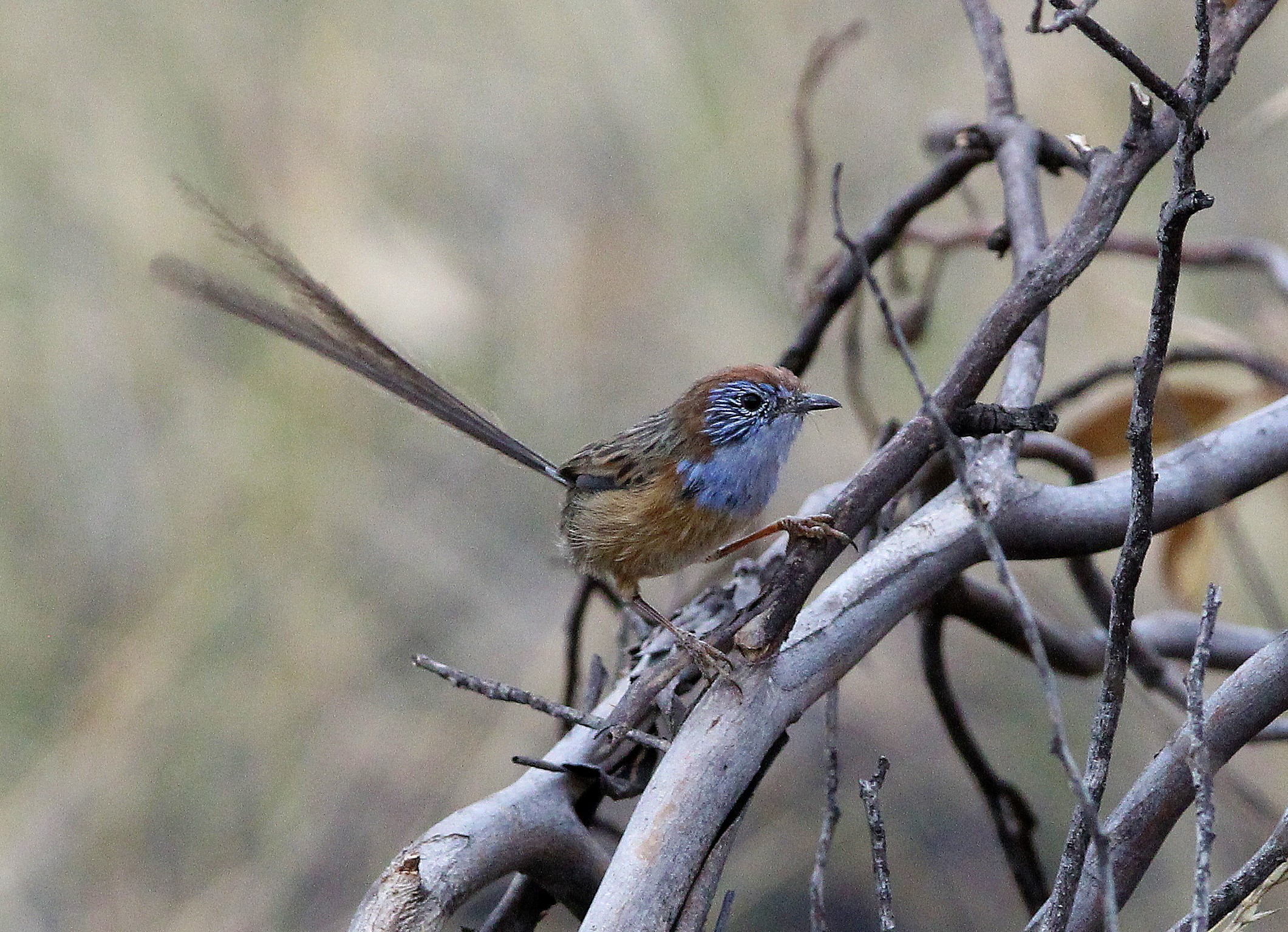
The endangered Mallee Emu-wren, photo by Steven Jmaes
Lake Tyrrell
Lake Tyrell
This vast salt lake north of Sea Lake is a good stop off on the way to the mallee. There are rarely any waterbirds present, it is the saltbush vegetation surround the lake that provides the interest.|
Getting there: The lookout, a few kms north of Sea lake on the Calder hwy is a good place to start. In dry weather it is possible to drive around the lake, but any rain at all and it’s walking only as the salty clay quickly turns into a sticky ice rink. New fendes have been erected followin many tourist boggings so acces now more restricted. Access is also possible from the Robinvale - Sea lake road where the Tyrrell creek runs into the lake.
Key sites: Extensive areas of saltbush habitat are found right around the lake, especially on the eastern side, with the key species occurring widely. For a quick stop the lookout is convenient.
Key Species: Rufous Fieldwren, White-winged Fairy-wren, Orange Chat, Black-faced Woodswallow
Orange Chat
Timberoo Flora and Fauna reserve
Mulga Parrot
This fairly small reserve south-west of Ouyen preserves some good quality cypress pine and casuarina habitat, which is now much depleted in north-west Victoria. There are few facilities, just a quiet and beautiful piece of pine woodland to wander in.
Getting there: Take the Ouyen-Patchewollock road south-west from Ouyen and after around 14kms turn right onto Scott Road. This takes you through the north-eastern part of the reserve. At the five way junction turn left heading south to join McIlvena road where you can turn right and eventually come out on the Walpeup lake road near Lake Walpeup which is usually dry. This route will take you through some of the best birding spots
Key Species: White-browed Treecreeper (rare but scattered throughout), Mulga Parrot, Splendid Fairy-wren, Little Eagle, Gilberts Whistler, Apostlebird (sometimes seen along Scott road)
Wandown Wildlife Reserve
One of a number of undeveloped mallee woodland reserves with no facilities and just a few sandy 4WD tracks. Wandown is a quality bit of mallee country on deep sandy dunes with a healthy population of Malleefowl plus other mallee specialities. The nearby Menzies block, just east of Marshell road is very similar country
Getting there: Wandown reserve is south-west of Boundary bend. Access from Koorkab road which runs between Annuello in the west and Haysdale in the east. The roads to get there, and those which go right around the perimeter, are kept in good condition, as are many mallee roads made for large agricultural machinery. Inside the reserve is definitely 4WD only, and it’s possibly just as good to wander in on foot. As with any mallee reserve, it is easy to become disorientated so never take chances on finding your way back to where you started.
Key Species: Emu, Malleefowl, Regent Parrot, Mulga Parrot, Splendid Fairy-wren, Chestnut Quail-thrush, Crested Bellbird
Bronzewing Flora and Fauna reserve
As with Wandown, Bronzewing has no facilities and only 4WD tracks within the reserve, and as with Wandown it is a pristine expanse of mallee woodland well worth spending time in.
Unfortunately in early 2014 an extensive naturally occurring bushfire raised large parts of the reserve, which will take many years to recover fully to its former glory, however that recovery is well underway and the dense regrowth is already supporting plenty of birds.
Getting there: The Sunraysia highway runs through the reserve from 10 to 20 kms south of Ouyen. Merrett road runs along the northern boundary and there are any number of access points.
It is also possible to access the reserve from the highway itself or from the track running west from Gypsum on the highway.
Key Species: Emu, Malleefowl, Regent Parrot, Mulga Parrot, Spotted Nightjar, Splendid Fairy-wren, Chestnut Quail-thrush, Striped Honeyeater, Shy Heathwren, Southern Scrub-robin
Little Desert National Park
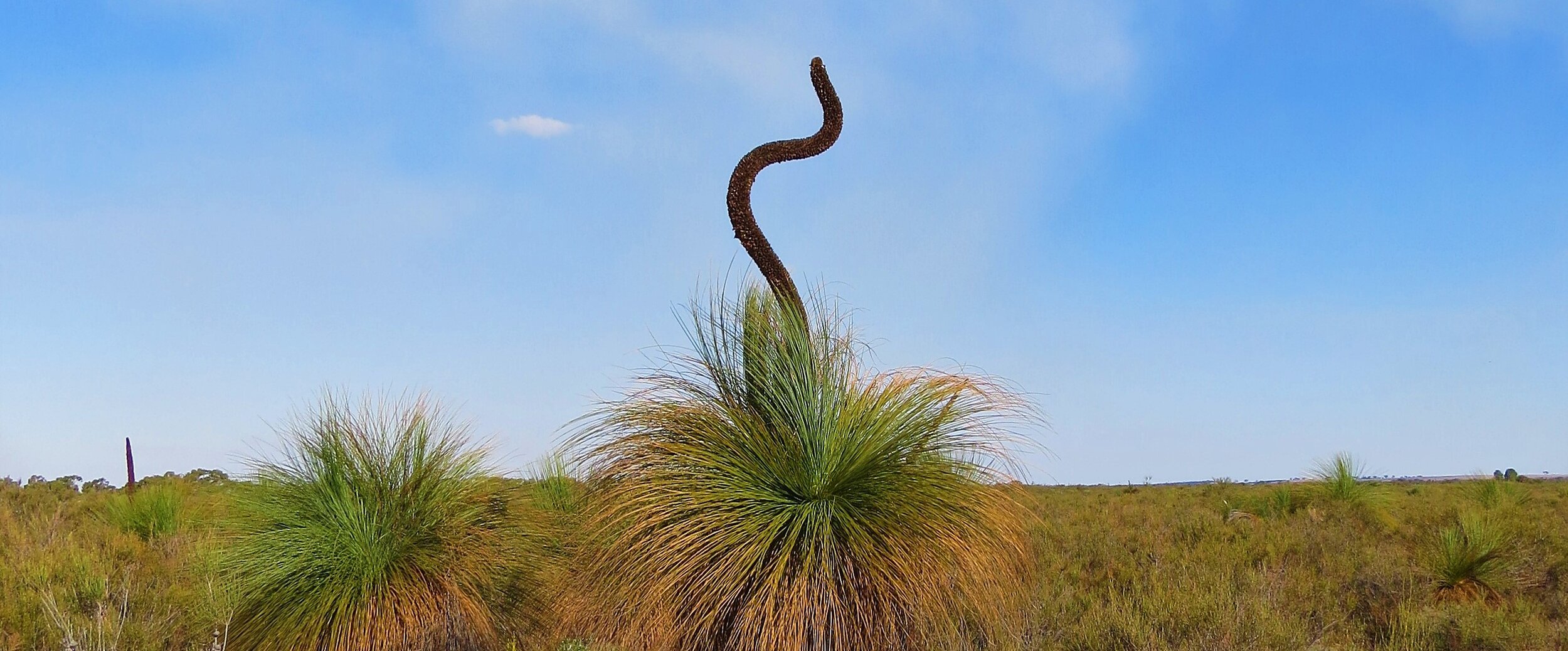
Grass trees ( Xanthorrhoea )
In the southern part of the mallee region lies the Little Desert. A desert in name only as this park receives a relatively generous annual rainfall, however over much of the reserve the soil is made up of a loose white sand ( the lowan mallee), except for its eastern boundary close to the small town of Dimboola which is alongside the Wimmera river. This is a nice place to start any visit where a drive along river track through Black Box woodlands can be quite birdy with a range of woodland birds.
But it is the highly adapted vegetation growing on the poor sandy soils that provides a home to the rarer more specialised bird species. The nature of the very loose sand here means that most tracks are definately high clearance 4WD only but easier access can be made in the north near Kiata and also along the Nhill Harrow road.
The road into Kiata campground passes through mallee broombush habitat with Shy Heathwren, Southern Scrub-robin, Purple-backed Fairy-wren and occasional Malleefowl sightings. Walking tracks take you through this interesting environment. The first part of Salt lake track is possible in 2WD and gets you further into the mallee. Look out for Purple-gaped and White-fronted Honeyeaters. At the campground itself open Yellow Gum woodland is always interesting.
The Kiata Sanctuary, on the north side of Kiata south road, has a nature walk and the opportunity to view a Malleefowl nest mound which is active in some years.
Along the Nhill Harrow road stops are worth making anywhere there is bird activity. Tawny-crowned and White-fronted Honeyeaters can be abundant when the right plants are flowering, whilst the very low heathlands are home to Blue-winged Parrot, Purple-backed Fairy-wren, Rufous Fieldwren (winiam ssp) and Slender-billed Thornbill ( beware the similar Buff-rumped Thornbill which also occurs ).
Blue-winged Parrot
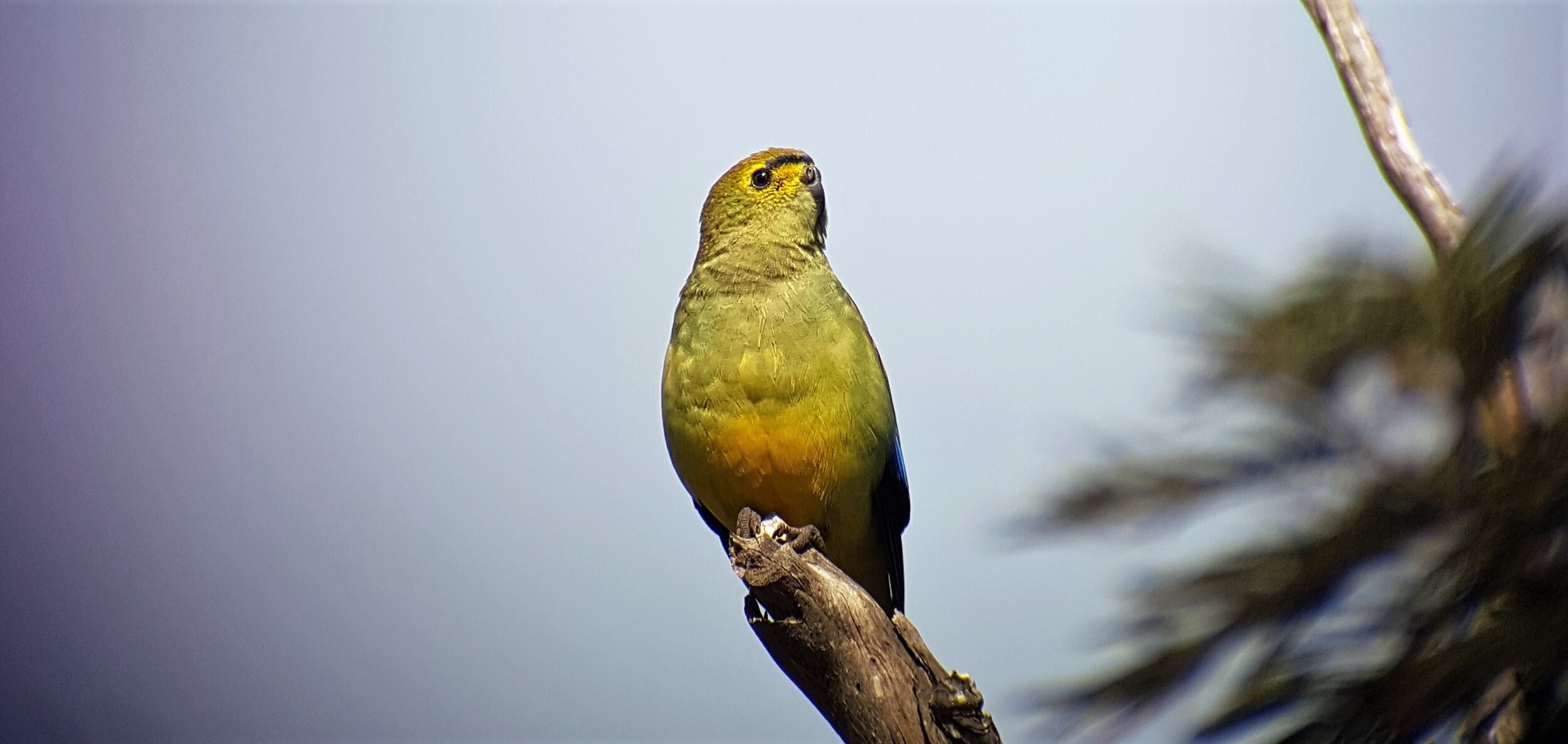
In summer Elegant Parrots have been seen in the area, one of very few sites in Victoria for this species.
Just to the south of the Little Desert many interesting sites are worth visiting, especially the rocky outcrops of Mt Arapiles, Jilpanger Nature Conservation Reserve and the salt lakes in the region especially Mitre lake, White Lake, Lake Wyn Wyn and Oliver Lake all of which can play host to enormous concentrations of Banded Stilts in late winter and spring depending on the year
